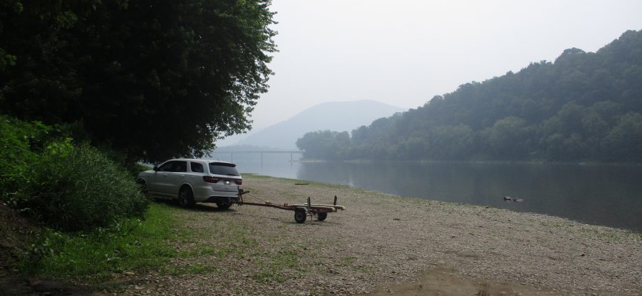

The view of the Susquehanna River bridge at Tunkhannock in Wyoming County was all but occluded by Canadian wildfire smoke again on Thursday, as seen from the public boat launch in Riverside Park. The haze is expected to clear over the next 24 hours as warm, humid air rushes in to bring us thunderstorms for the holiday weekend.

Weather synopsis and photos by Rick Hiduk
Air quality alerts were issued for wide swaths of north-central and northeastern United States over the past few days as smoke from wildfires still burning in Canada blanketed the region.
The good news is that the smoky air should not last as long as it did several weeks ago. But it will be replaced by a muggy air mass similar to what we experienced over the past week, producing scattered thunderstorms daily through Independence Day.
The long-term forecast follows:
Thursday night: 58 hazy
Friday: 86/65 late T-storms
Saturday: 80/65 scattered storms
Sunday: 80/68 scattered storms
Monday: 80/65 scattered storms
July 4th: 82/64 scattered storms
Wednesday: 85/68 mostly cloudy
Thursday: 87/68 partly cloudy
Friday: 84/64 PM showers
The EndlessMtnLifestyles.com weather report is based on expected conditions at approximately 1,100 ft elevation in Meshoppen Township, Wyoming County, near the center of the Endless Mountains region. Residents of river towns can generally expect slightly higher temperatures, while those at higher elevations may experience lower temperatures. Send your Weather Window photos to endlessmtnlifestyles@gmail.com. Try to include a good horizontal/panoramic shot.