
By Rick Hiduk
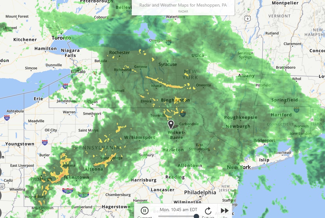
A Weather.com radar image (top) from 10:45 am centered on Meshoppen in Wyoming County shows a potential break from heavy rains for Wyoming County in the next two hours, but not so much for residents of Bradford, Sullivan, and Susquehanna counties, where water is already covering roadways in poor drainage areas and beginning to swell streams.
The general forecast is for the remnants of Tropical Storm Gordon to continue to wring itself out over the region into early evening. There is also a chance for thunderstorms Tuesday through Thursday as warmer, humid air moves up from the south.
Early predictions on the course of Hurricane Florence, now strengthening as it drifts westward across the Atlantic Ocean suggest that the storm will make a direct hit on the Carolina coastal region on Friday then drift north inland over Virginia, Maryland and Pennsylvania on Saturday and Sunday.
Sugar Creek and Towanda Creek in Bradford County are climbing swiftly this morning, as is the Loyalsock Creek in Sullivan County and Choconut Creek in Susquehanna County. No serious flooding is predicted at this time (as shown on the weather.gov prediction graph above), though flood watches have been posted for the entire area.
Residents in flood-prone areas are encouraged to remain vigilant and prepare to evacuate to higher ground. Please send any storm photos that can be procured safely to endlessmtnlifestyles@gmail.com or as a message to the Endless Mountains Lifestyles Facebook page.